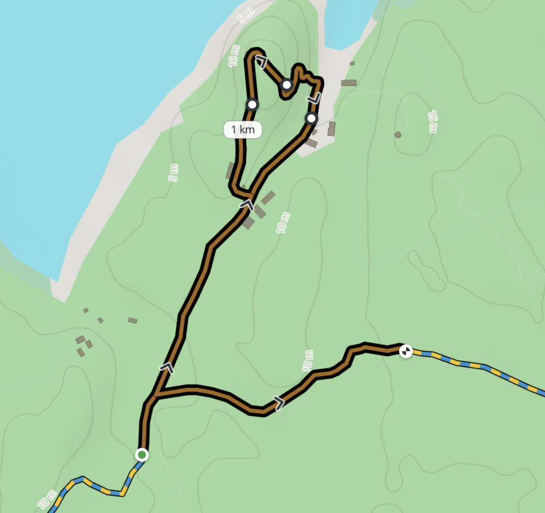
Closures shown as areas. When the trail managers close a part of an island — for example during forestry work — the affected area is now shaded on the map instead of being marked by a single pin. Closed areas are hatched, and the popup states whether the trail is passable.
September 2026
Night mode, earlier places and reliable offline maps
A complete night map. Night mode now darkens the whole planner — search, side panels, menus, map controls, trail markings and place pins — instead of changing only the basemap. It is never tied to the time of day: choose day or night from the map menu and the planner remembers your choice.
See places sooner. Place clusters appear from a wider overview, then unfold into coloured categories and individual pins as you zoom in. They remain visible while you are planning a route, so cafés, shelters, water and sights do not disappear just when you need them.
Save an area for offline use. “Save map area offline” now stores both the visible map and the routing data needed to keep planning with a poor or missing connection. The cache is bounded to protect phone storage and has been hardened for Safari.
Shorter route links. Routes with many waypoints now use a compact link format that is much easier to copy and share. Existing links remain compatible.
Faster and steadier. The initial map load is lighter, large route calculations have safer limits, and the app has more resilient fallbacks when live services are slow.
Keyboard polish. Confirmation dialogs now have a clear default action: press Enter to confirm or Escape to cancel. Map markers and other controls have also gained better keyboard support.
August 2026
Plan your hike inside ChatGPT
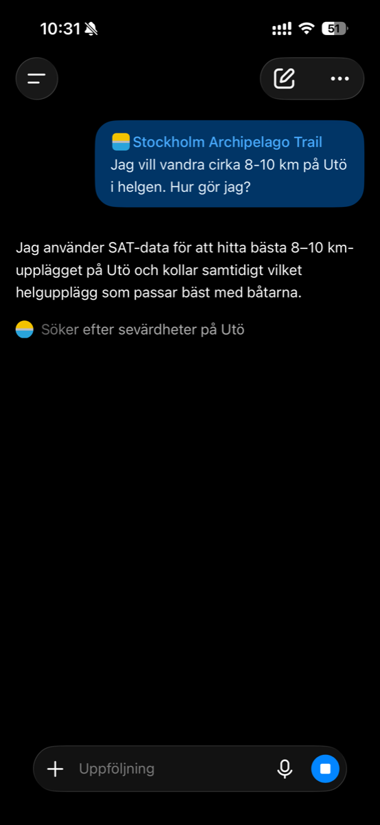
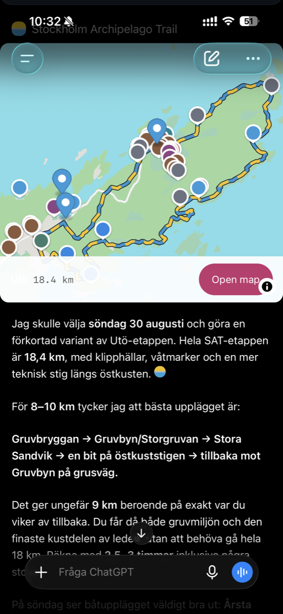
The trail now has its own app in ChatGPT. Ask in plain words — “I want to hike 8–10 km on Utö this weekend, how do I do it?” — and it plans the walk from real trail data, checks which ferries fit, suggests places to see along the way and shows the stage on a map you can open in the planner.
What it can do. Suggest a stage for a day trip or a multi-day hike, shorten or lengthen a walk to the distance you want, pair it with ferry departures for a given date, list cafés, beaches and sights on the island, and show any stage on a map.
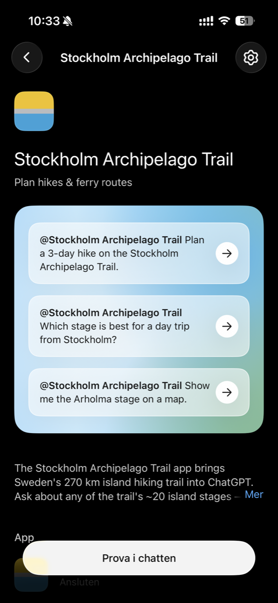
How to install it. Open Stockholm Archipelago Trail in ChatGPT and tap Try in chat, or search for “Stockholm Archipelago Trail” under Apps in ChatGPT. Then start a message with @Stockholm Archipelago Trail and ask away.
Same data as the map. The app reads the same open trail data (CC BY 4.0) and ferry timetables as this planner, so what it tells you matches what you see here.
July 2026
Share a link and people see what you shared
Routes. Send someone a route you’ve planned and the link now unfurls into a picture of that route drawn on the map, with the island around it. Previously every link showed the same generic photo, so a shared route looked like a link to the front page.
Places, sections and piers. The same goes for a café, a viewpoint, a trail section or a ferry pier: the preview shows its photo — or, when there is no photo, the map with that exact spot marked out.
July 2026
Watch your route come to life
See how it runs. When you plan a route — a ready day trip or one you build yourself — a marker now glides along the hike so you can follow exactly where the trail goes. Replay it any time from the route timeline or the editing toolbar.
Retrace your steps. Tap a stretch of a route you’ve already drawn and choose End here to extend it to that spot — so a there-and-back along the same path finally just works — or drop a waypoint mid-line instead.
July 2026
Plan the bus or train to the ferry
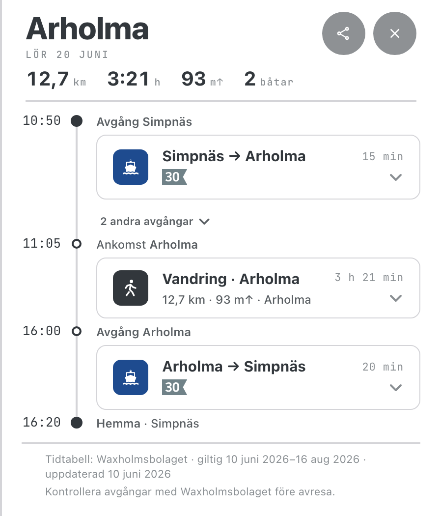
Getting to the pier, sorted. When your route starts or ends at a mainland ferry pier, you can now add the public-transport leg — bus or train — straight into the trip timeline, with departure times and how much margin you have before the boat.
Opt-in, never in the way. Ferries and hiking stay the focus; the connection only loads when you ask for it, and you can remove it again with a tap.
A cleaner timeline. Boat, hike and transport now read as one consistent, tappable sequence from door to trail.
June 2026
Keep a logbook of the stages you’ve walked
Tick off each stage. Open an island and tap “Mark as walked” — the pill turns green to show you’ve done that stretch of the trail.
Stays on your device. Your logbook is saved locally in your browser; there’s no sign-up and nothing leaves your phone.
June 2026
Add your boat to your calendar
Don’t miss the ferry. On a boat leg in your route, tap “Add to calendar” to save the departure — with a reminder 30 minutes before so you’re at the pier in good time.
Right time, anywhere. The event lands at the correct local time whatever time zone your device is set to.
June 2026
More places on the map
Churches & chapels. The archipelago’s landmark churches and chapels — Möja, Nämdö, Arholma, Utö, Sandhamn and more — now show up as places to visit, along with a historic burial chapel on Ornö.
More beaches, better named. Many more swimming spots are on the map, and beaches that were unnamed now carry their real name where one exists.
Refreshments. Ice-cream and coffee kiosks, like the one on Nåttarö, are in too.
Tidy up the map. A new switch in the layers menu lets you hide the kilometre markers along the trail for a cleaner view.
June 2026
How warm is the water?
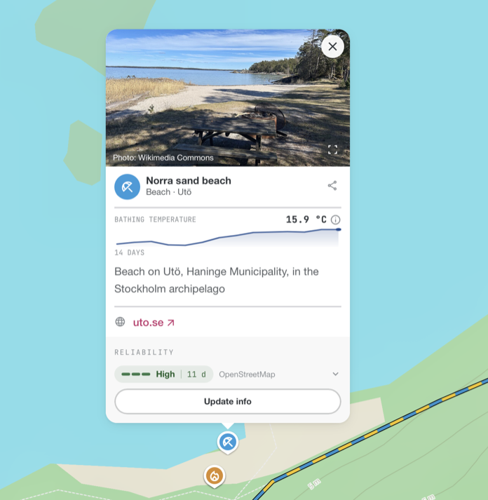
Sea temperature on every beach. Open a beach and its card shows the current water temperature, with a small sparkline of the last 14 days so you can see whether it’s warming up.
Know what you’re reading. Tap the ⓘ for context — it’s a model value for the surrounding water, and a sheltered bay can be a few degrees warmer than the open fjord.
Fresh and credited. Sea data comes from Open-Meteo, refreshed daily; it appears in the per-field source breakdown alongside how recently it was updated.
June 2026
Build your own route, point by point
Draw it yourself. Click the map to drop points — the route follows the nearest trail between them. Drag a point to reshape it, right-click to remove, or close a loop back to the start.
Add the ferries. When your walk needs a boat there or back, the planner suggests departures right in the timeline. Add one and it builds the short walk to and from the pier for you; switch to a different departure any time, with the earliest at 08:00 by default.
Your way. Reverse the direction, and choose whether each leg follows the marked trail or the shortest path.
Save & share. Save a route to reopen later, or share a link that restores the whole trip — timeline, map and layers included.
June 2026
Cross between Finnhamn and Ingmarsö by rowboat
The rowboat is now part of the route. Plan a trip between Finnhamn and Ingmarsö and the planner can send you across on the free self-service rowboats (“Båtluffarleden”) — you row yourself over — instead of waiting for a ferry.
What you need, on the spot. The crossing appears in the route timeline marked as a free, row-yourself boat, with a number to call if the boats have drifted to the wrong shore.
In season only. The rowboats run 1 May–31 October; outside that the planner takes you by ferry instead.
June 2026
Tell us what to build next
Suggest a feature. Got an idea for the planner? Open “Wishlist” from the ⋯ menu and add it in a sentence — no account needed.
Back the ideas you like. Browse what others have suggested and upvote your favourites; the most-wanted rise to the top.
Follow along. Each idea shows where it stands — proposed, planned or done.
June 2026
Trail photos, pinned where they were taken
See the path before you walk it. Open a stage and photos of the trail appear on the map at the exact spots they were taken — tap one for a full-screen view with photographer and licence.
Tidy as you zoom. Nearby photos group into a single thumbnail with a count, then spread out as you zoom in.
Your choice. Turn the “Trail photos” layer on or off from the layers menu.
Photos come from Wikimedia Commons (CC0/CC-BY).
June 2026
Sharper trail lines, plus surface & terrain
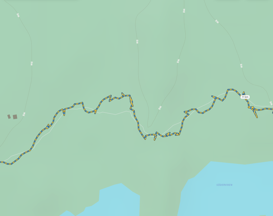
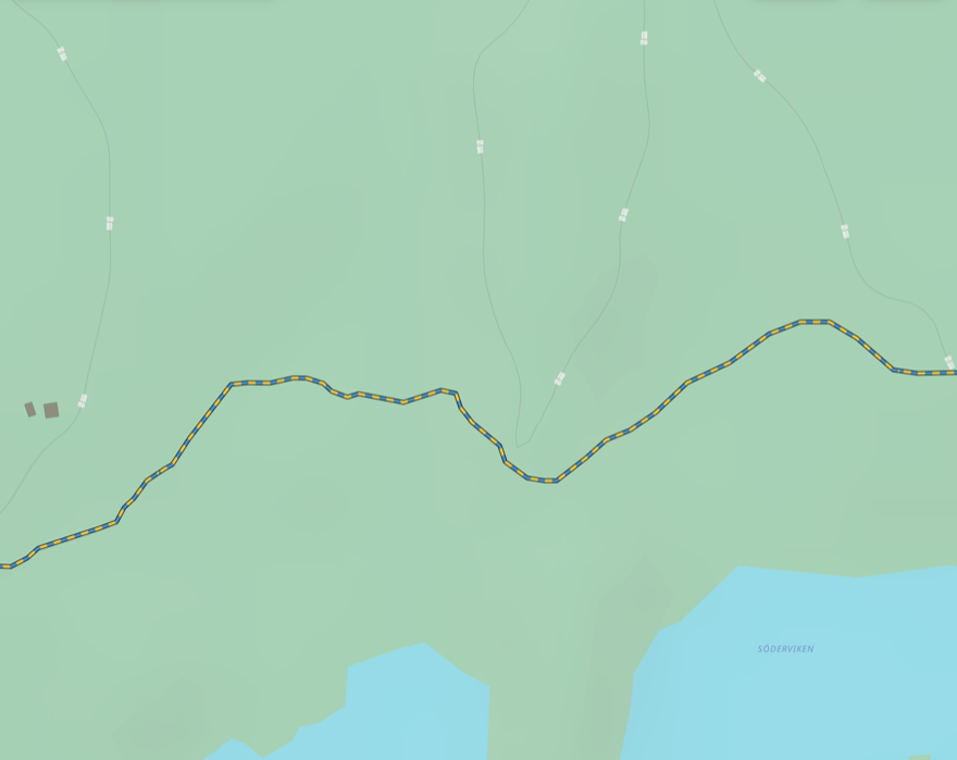
Truer to the path. Each stage’s trail line now hugs the real, mapped route more closely — fewer wobbles and stray detours, so the line on the map matches the path under your feet.
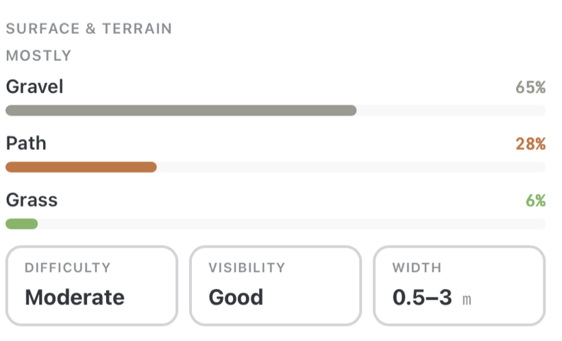
Know the ground before you go. A new “Surface & terrain” panel on each stage breaks down what you’ll walk on as coloured bars (gravel, path, grass…), and shows how demanding it is, how easy the path is to follow, and roughly how wide it gets.
Photos along the way. Stages now show pictures of the actual trail.
Before — the recorded GPS track, wobbling off the path (dashed) it should follow.After — snapped to the mapped trail: smooth and true to the real route.The Surface & terrain panel on each stage.
Trail surface, terrain and photos come from OpenStreetMap and Wikimedia Commons.
June 2026
See the ferries move in real time
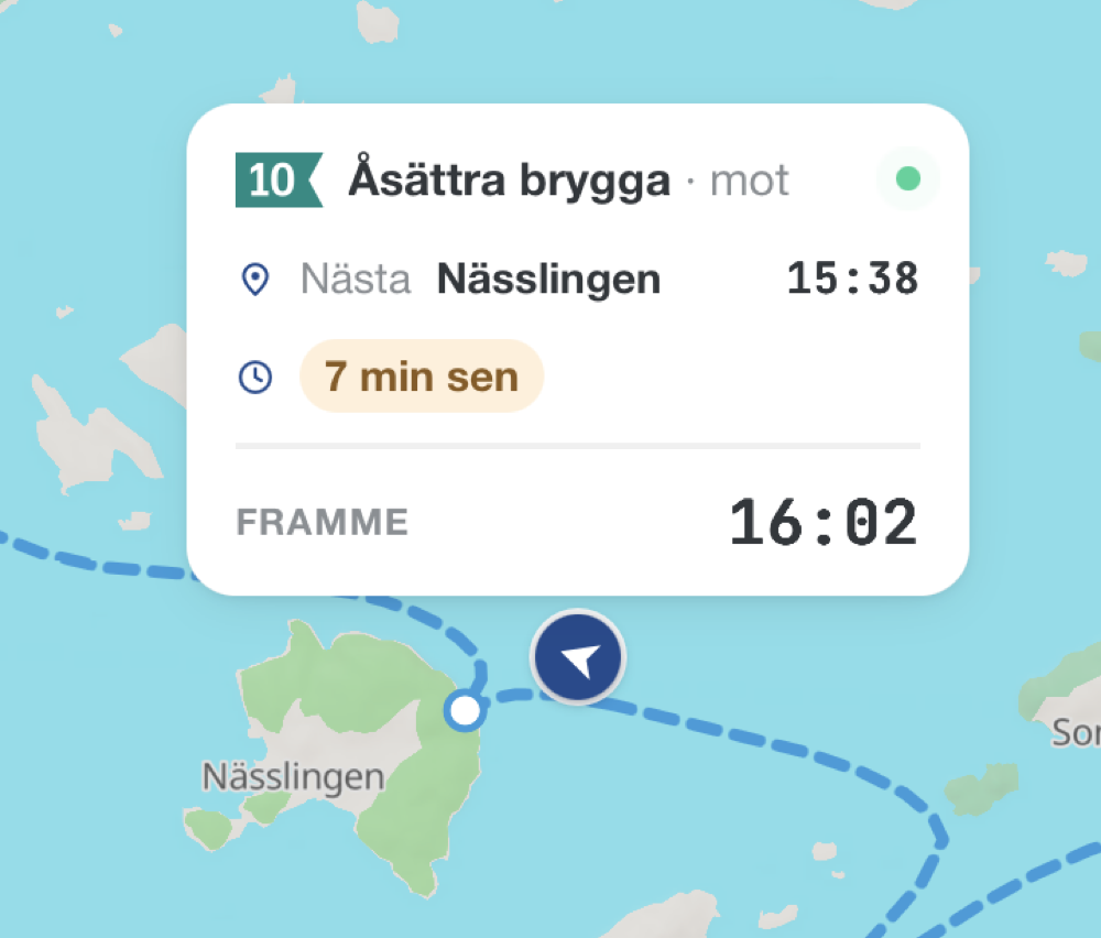
Live boats on the map. Turn on the “Live boats” layer and the archipelago ferries appear as moving arrows, gliding along their routes and updating continuously.
Tap a boat for the details. A card shows the line pennant and destination, the next pier with its estimated time, whether it’s on time or delayed, and the final arrival — and it draws that boat’s actual route for the trip.
June 2026
Follow your position as you walk
Live tracking. Tap the location button once to drop a pin where you are; tap again to switch on live mode — the map now follows you as you walk the trail, the dot updating in real time.
Pan to look around. Drag or zoom the map and it stops chasing you, but your position keeps updating. Tap the button again to re-centre, or once more to turn tracking off.
Stays awake while you walk. Live mode now keeps the screen on so the map keeps following you instead of dimming away — and it picks up where it left off if anything interrupts it. It still pauses when you switch to another app and turns itself off after 20 minutes, so it never quietly drains your phone in your pocket.
Your location never leaves your device — nothing is logged or sent anywhere.
June 2026
A redesigned trip planner
Plan from the start screen. The landing screen opens with a carousel of islands to walk — tap “Plan trip” and it expands straight into the planner, no separate menu step.
The whole trip in one card. Departure pier, the island or stage to walk, and where to finish now sit together in a single card, with date and pace right alongside.
Choose where to end. Trips are a round trip back to your departure by default — or pick a different end pier for a point-to-point walk. The end follows your departure until you change it.
See reachability as you choose. Each island in the destination list shows its distance, the departure hub, and how many ferries a day actually serve it — so you can tell a well-connected island from a once-a-day one before you commit.
“Any pier” planning. Not sure which hub to leave from? Pick “Any pier” and the planner finds the fastest way out to the island for you.
June 2026
Shareable links that survive Facebook
Links you copy from a place, ferry pier or trail stage now use a single canonical form — /?id=… — that keeps working when shared on Facebook and other platforms. Previously a shared link could break when the platform reformatted the address. Older links, and direct links from OpenStreetMap, keep working too.
June 2026
Search by ferry line number
Type a line number — 13, 53, 83 — into the search box and the ferry line now shows up as a result, marked with its official Waxholmsbolaget pennant. Pick it and the line’s whole network is drawn across the archipelago with every pier it calls at, framed so you see the full route — the same view you get by tapping a line badge on a pier panel.
June 2026
Right-click the map — coordinates, sharing & measuring
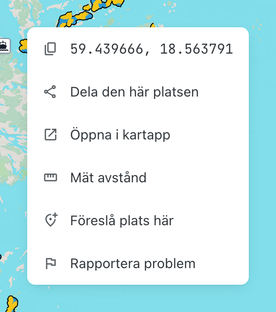
Right-click (or long-press) anywhere on the map for a new context menu: copy the exact coordinates, share a link to that spot, open it in Apple or Google Maps, suggest a missing place or report a problem — or measure distances with a tap-to-add ruler that shows the total and an estimated walking time as you go.
June 2026
Smarter trip details — last boat, tight transfers & island time
Last boat of the day. When your chosen return departure is the last boat home that day, the timeline now says so right on the boat card — so you know there’s no later option before you commit to it.
Tight transfers flagged. A wait under 10 minutes between legs gets a clear “tight transfer” marker in the timeline, matching the warning you already see on island cards.
Compare departures by island time. The departures list and the “all departures” view now show how much time on the island each alternative gives you — compare options at a glance instead of trying them one by one.
More on every island card. Trip suggestions now show the stage difficulty and your actual time window on the island, computed from the boat pair.
Carousel in trail order. The island carousel on the start screen now follows the trail’s official north-to-south stage order — same order every visit.
June 2026
See where every boat goes
Boat lines on the map. Every pier panel now shows which lines serve it — tap a line badge and its whole network is drawn across the archipelago, with every pier it calls at.
Follow a single departure. Each departure on the board has a route button that draws exactly that boat’s journey — every pier on the way with its arrival time. Finally an answer to “where does the 13:40 actually go?”.
Plan ahead. Step the departure board to any future date and browse the full day’s timetable — route buttons included. Today still shows what’s left right now.
All of it shareable. The drawn line, the chosen departure and the board’s date all live in the address bar — reload or share and the view comes back.
June 2026
Links that last, stage navigation & firepits
Everything has a link now. Open a place, an island stage or a pier and the address bar follows along — reload the page and the same card reopens, copy the address and the recipient lands exactly where you were. Every card also has its own copy-link button.
Links that never break. Every place, stage and ferry pier carries a permanent identifier that survives renaming and upstream database changes — an old shared link keeps working even years later, and a place that disappears tells you it’s gone instead of turning into a dead link.
Walk the trail stage by stage. Island cards now show where the stage sits in the official north-to-south order — “Stage 10 of 20” — with previous/next buttons to step along the trail from Arholma all the way to Landsort.
Copy any identifier. The place card’s “Object IDs” section lists the SAT, OpenStreetMap and Wikidata identifiers with a one-tap copy button next to each — and the history link now covers the object’s full edit history, even across OpenStreetMap renumbering.
Firepits from grillplatser.nu. Over 50 firepit and barbecue sites across the islands, with facilities and photos, maintained by grillplatser.nu — each one links back to its source page for updates at the source.
The trail as open linked data. The whole trail — stages in official order, lengths, elevation and route geometry — is now published as one machine-readable document following the Swedish national specification for trails, alongside a redesigned Data & Sources page with the full identifier policy and open endpoints.
June 2026
Ferry piers — live times, photos & shareable links
Tap a pier for today’s boats. Ferry piers — both the mainland departure hubs and the island piers — now open a panel showing the day’s upcoming departures and arrivals, with the line and where each boat is heading or coming from.
Live delays. When real-time data is available, a delayed or cancelled boat is flagged right on the board, so you’re not left waiting on a time that has already slipped.
Pier photos. Many piers now show a photo at the top of the panel, sourced from Wikimedia Commons with per-image credit.
Link straight to a pier. Every pier has a shareable link (a “copy link” button in the panel) that opens the map centred on that pier — handy for sending someone exactly where to catch the boat.
June 2026
Self-hosted maps, sharper trails & open data
Self-hosted maps everywhere. Every map — public and admin — now runs on our own Protomaps vector tiles. No third-party map provider.
Sharper trail lines. Coarse, jagged GPS tracks are automatically cleaned (GPS spikes removed) and snapped to the underlying OpenStreetMap paths, so the trail follows the real route. Several sections were also re-recorded from higher-quality GPX.
Reliability indicator on every place. Place cards now show a trust meter (high / medium / low) that weighs the source’s authority, how fresh the data is — opening hours age faster than a viewpoint, seasonal hours fastest — and whether it’s cross-referenced. A mapper’s “needs checking” flag lowers it, and expired or seasonal hours show clearly. “Show details & IDs” reveals the per-field source and the object identifiers.
Place names & info in your language. Where OpenStreetMap or Wikidata has a name or description in your language (English, German or French), the place card now shows it instead of the Swedish original.
Non-drinkable water, clearly flagged. Water points marked as not for drinking now carry a red “no” strike on the map pin, the popup and the place list — so you don’t fill your bottle at the wrong tap.
Clearer opening hours. Today’s hours show at a glance, and complex seasonal schedules that don’t fit a single line are laid out readably under a tap-to-expand row instead of a wall of text.
Search by coordinate. Type or paste a coordinate into search — decimal degrees (58.882691, 18.119346) or degrees-minutes-seconds (58°52'57.7"N 18°07'09.7"E) — and the map flies straight to it.
Follow your report. After reporting a problem you get a private link to a status page — received → in progress → resolved — with the case number and any update from the team.
Built to be referenced. Every place shows its persistent OpenStreetMap / Wikidata identifier, and the open data endpoints, permalinks and dated history snapshots are documented on the Data & Sources page.
Report a place as gone. You can flag a place that no longer exists; an admin reviews it and updates OpenStreetMap (marked disused, or removed).
CC0 for photos. Photos you upload are released as CC0 (public domain) for the easiest reuse.
Multi-day discovery. Pick several islands freely for longer trips; the planner now routes between islands that have no direct ferry, with clear recovery options when a day doesn’t work out.
Early June 2026
Defibrillators & a rebuilt map engine
Defibrillators (AED). Defibrillator locations now come straight from Sveriges Hjärtstartarregister (the Swedish AED Registry), refreshed daily, with availability hours and the registered owner. Where a defibrillator is also mapped in OpenStreetMap, we use that community-verified position for a more accurate pin.
Native vector map. The map was rebuilt on native MapLibre GL for smooth, continuous zoom — and POI markers became proper map pins with clustering.
Late May 2026
Community places & richer info
Suggest and update places. You can propose a new place or edit an existing one — name, category, opening hours, phone, website, address, accessibility and a photo. Submissions are reviewed by an admin and contributed back to OpenStreetMap.
Richer place cards. Place popups now show an open-now status, photos, a Wikipedia summary, address, and where the information comes from.
Availability-aware day trips. Days without a possible trip are greyed out, and the planner jumps to the next available date.
Advance-booking warnings. Call-to-order ferry departures are flagged so you don’t miss a required phone booking.
Live problem reports. Ongoing issue reports are shown directly on the public map.
Mid May 2026
Offline, search & a fresh look
Works with limited connectivity. The installable app pre-caches its shell and routing data. Map areas you have viewed are retained opportunistically, but a connection may still be needed for uncached map tiles and live traffic.
Place search. A search box to jump to islands, ferry docks and points of interest.
Redesigned timeline. The route view became a clear event rail — walk, wait, ferry and overnight segments at a glance.
Island inspiration. A carousel of islands on the landing screen to spark a day trip.
Early–mid May 2026
Trip wizard & a fresh design
Plan-a-trip wizard. A guided flow to pick dates, duration and pace.
Design overhaul. A consistent visual system across the whole app.
April 2026
Launch — the routing foundation
Multimodal routing. A→B trip planning that chains walking and Waxholmsbolaget ferries (walk → ferry → walk), aware of weekday, date and season.
Discover. See which islands you can reach from a mainland hub within a day or a weekend.
The whole trail. All 22 sections of the Stockholm Archipelago Trail, with a GPX-to-map data pipeline.